

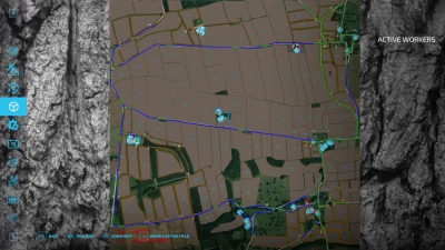
Full English Autodrive course, Road network mapped as primary routes with field access's mapped as secondary routes including field boundaries (only a 30-40% of Fields have been plotted so far, will release V2 once all fields are plotted). Fields grouped 1-9 10-19 Etc. sell/buy points etc. grouped into villages. All farms have at least one navigable point and are grouped as colours
Note: The map has a large area of two-way primary network due to fields being accessed from single lane roads whilst passing places are included limit the number of vehicles using this area at any given time to avoid blockages.


COMMENTS
There are no any comments
Write a comment